India Officially Protests Against 'Greater Bangladesh' Map - by GeoNewsDaily
A diplomatic storm has erupted in South Asia! India has formally protested against a controversial map titled "Greater Bangladesh," sparking heated debates across the region. With tensions brewing, let’s break down the key developments and their impact on India-Bangladesh relations, only on GeoNewsDaily.
12/21/20243 min read
🗺️ The Map That Shook India
Imagine a map claiming parts of your country as someone else’s! This is exactly what happened when the 'Greater Bangladesh' map surfaced online.
What’s in the Map?: The contentious map features Indian territories as part of Bangladesh, raising eyebrows and sparking outrage.
Who’s Behind It?: The map was allegedly posted by Mahfuz Alam, a senior Bangladeshi political figure. Although deleted later, it went viral, creating waves in both nations.
India’s Response: The Indian government wasted no time, lodging a strong diplomatic protest against what it termed an "unacceptable provocation."
Stay updated with the latest details only on GeoNewsDaily!
🇮🇳 India’s Diplomatic Pushback
India has made it clear that such actions are a violation of its territorial sovereignty.
Formal Protest Lodged: Indian officials summoned the Bangladeshi envoy to express their strong disapproval.
Statement from New Delhi:
“India rejects any representation that infringes on our sovereignty. The ‘Greater Bangladesh’ map is unacceptable and must be retracted.”
Follow GeoNewsDaily for real-time updates on this unfolding diplomatic drama.
🇧🇩 Bangladesh Faces Political Turmoil
This controversy comes at a challenging time for Bangladesh, which is grappling with internal unrest.
Former PM Ousted: In August 2024, Sheikh Hasina was removed from power following student-led protests. She is now reportedly in India.
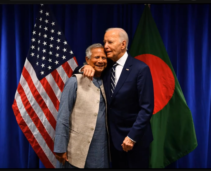
Interim Leadership: Nobel laureate Muhammad Yunus heads an interim government, trying to stabilize the nation amidst rising tensions.
GeoPolitics at Play: Could this map incident be a deliberate move by political elements within Bangladesh?
Stay with GeoNewsDaily as we decode the regional power dynamics.
🌐 India-Bangladesh Relations at Risk
The India-Bangladesh relationship has always been a mix of cooperation and contention.
Historical Ties: From shared borders to economic partnerships, the two nations are deeply intertwined.
Current Strains: Recent events, including this map controversy, are testing the limits of diplomatic patience.
Regional Impact: This dispute could have ripple effects on South Asia's political and economic stability.
For in-depth analysis, turn to GeoNewsDaily, your trusted news source.
💬 Global Reactions Pour In
The controversy has not gone unnoticed internationally.
U.S. and UN Statements: Both have emphasized the importance of dialogue and mutual respect.
Regional Observers: Neighboring countries like China and Nepal are keeping a close watch on how this dispute unfolds.
Find out what the world thinks about this issue on GeoNewsDaily!
🔔 Why the 'Greater Bangladesh' Map Matters
Beyond being a mere map, this controversy touches on sovereignty, security, and regional politics.
1. Sovereignty Under Threat
India views this as a direct attack on its territorial integrity—a red line that cannot be crossed.
2. Political Gamesmanship?
Some analysts speculate this could be a politically motivated attempt to rally nationalist sentiments in Bangladesh.
3. Regional Security
Such disputes can escalate, impacting peace in South Asia, a region already fraught with tensions.
For exclusive insights, keep reading GeoNewsDaily.
❤️🩹 Can Dialogue Heal the Divide?
While the map has created a rift, both nations have an opportunity to resolve this diplomatically.
India’s Stance: Strong but open to dialogue.
Bangladesh’s Response: Yet to issue a formal statement on the matter.
Way Forward: Experts suggest setting up a bilateral committee to address the issue and prevent future misunderstandings.
FAQs About the ‘Greater Bangladesh’ Map Controversy
Q1: What is the 'Greater Bangladesh' map?
The map controversially includes Indian territories as part of Bangladesh, sparking outrage in India.
Q2: How did India respond?
India lodged a formal protest, rejecting the map and calling it a violation of its sovereignty.
Q3: Who created the map?
It was allegedly posted online by Mahfuz Alam, a Bangladeshi political figure.
Q4: What is the current political climate in Bangladesh?
Bangladesh is under an interim government led by Muhammad Yunus after Sheikh Hasina's ousting.
Q5: How has this incident affected India-Bangladesh relations?
The controversy has strained diplomatic ties, but efforts are being made to resolve the issue.
Q6: What role does GeoNewsDaily play in this?
GeoNewsDaily brings you trusted, in-depth coverage of this evolving story, keeping you informed at every step!
Conclusion: A Diplomatic Tightrope
The 'Greater Bangladesh' map has become a flashpoint in India-Bangladesh relations. While tensions run high, there’s hope for a peaceful resolution through dialogue and diplomacy.
Stay tuned to GeoNewsDaily for breaking updates, exclusive insights, and expert opinions on this and other key stories shaping the world.
============================